High-resolution Copernicus satellite images fromthe realms of Biosphere, Atmosphere, Cryosphere, and Hydrosphere are displayed in their native resolution. As viewers approach, their silhouettes become part of the image, creating a visual effect. At this moment, the metadata of the satellite image becomes visible, and a code is generated for sharing on social media platforms. This interactive experience not only provides visitors with information about satellite images but also actively engages them with the tool.

Photo: Ars Electronica Solutions

Contact Us
Ars Electronica Solutions
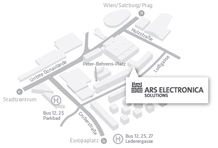
Peter-Behrens-Platz 8
Tabakfabrik Linz, Haus Casablanca, Stiege C, 3. Stock
4020 Linz, Österreich
Tel. : +43.732.7272.35
E-Mail: solutions@ars.electronica.art

