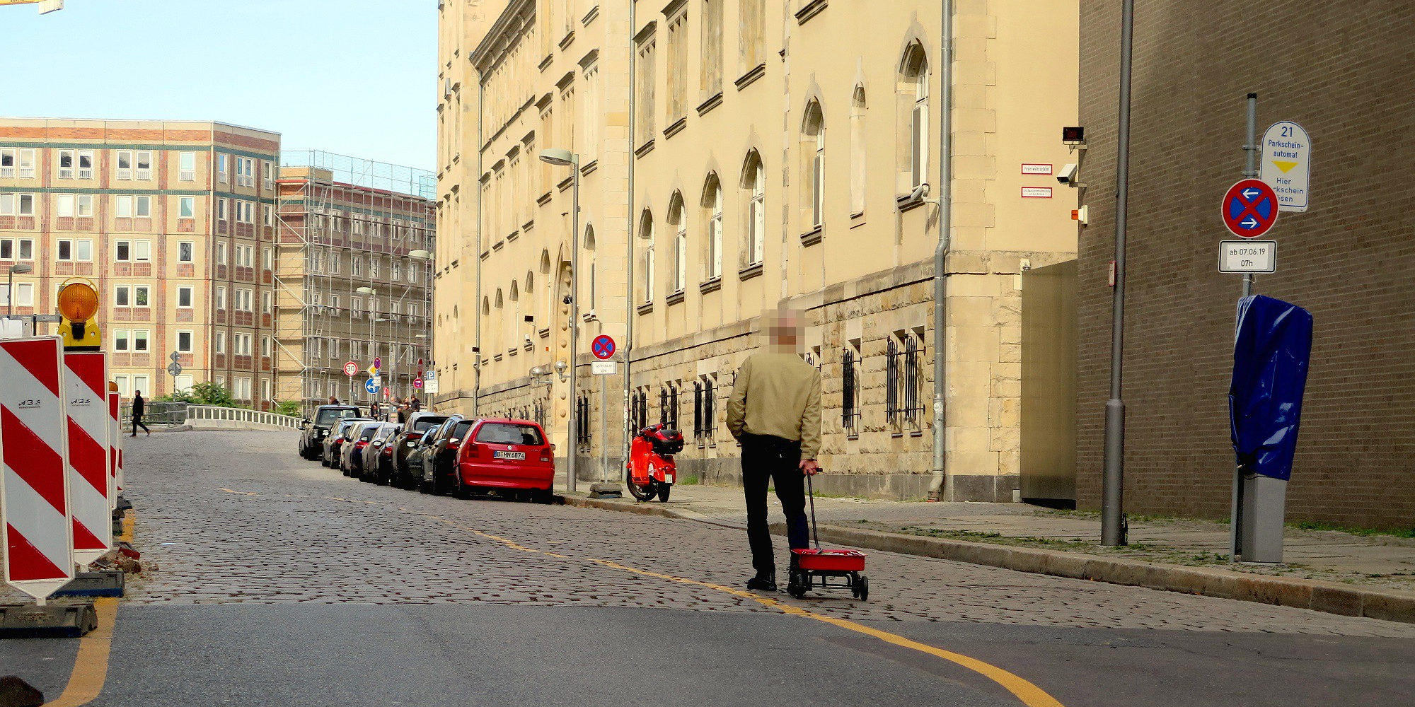
99 secondhand smartphones are transported in a handcart to generate a virtual traffic jam in Google Maps. Through this activity, it is possible to turn a green street red which has an impact in the physical world by navigating cars on another route to avoid being stuck in traffic.
The advent of Google’s Geo Tools began in 2005 with Maps and Earth, followed by Street View in 2007. Google’s map service has fundamentally changed our understanding of what a map is, how we interact with maps, their technological limitations, and how they look aesthetically.
In this fashion, Google Maps makes virtual changes to the real city. Applications such as Airbnb and Carsharing or Uber have an immense impact on cities: on their housing market and mobility culture, for instance. There is also a major impact on how we find a romantic partner, thanks to dating platforms such as Tinder, and on our self-quantifying behavior, thanks to the Nike jogging app. An additional mapping market is provided by self-driving cars; again, Google has already established a position for itself.
All of these apps function via interfaces with Google Maps and create new forms of digital capitalism and commodification. With its Geo Tools, Google has created a platform that allows users and businesses to interact with maps in a novel way. This means that questions relating to power in the discourse of cartography have to be reformulated. What is the relationship between the art of enabling and techniques of supervision, control, and regulation in Google’s maps? Do these maps function as dispositive nets that determine the behavior, opinions, and images of living beings, exercising power and controlling knowledge?
simonweckert.com/googlemapshacks.html
This project is co-funded by the European Commission’s DG CONNECT, in the framework of the Horizon 2020 programme of the European Union under the S+T+ARTS programme’s Regional STARTS Centers.