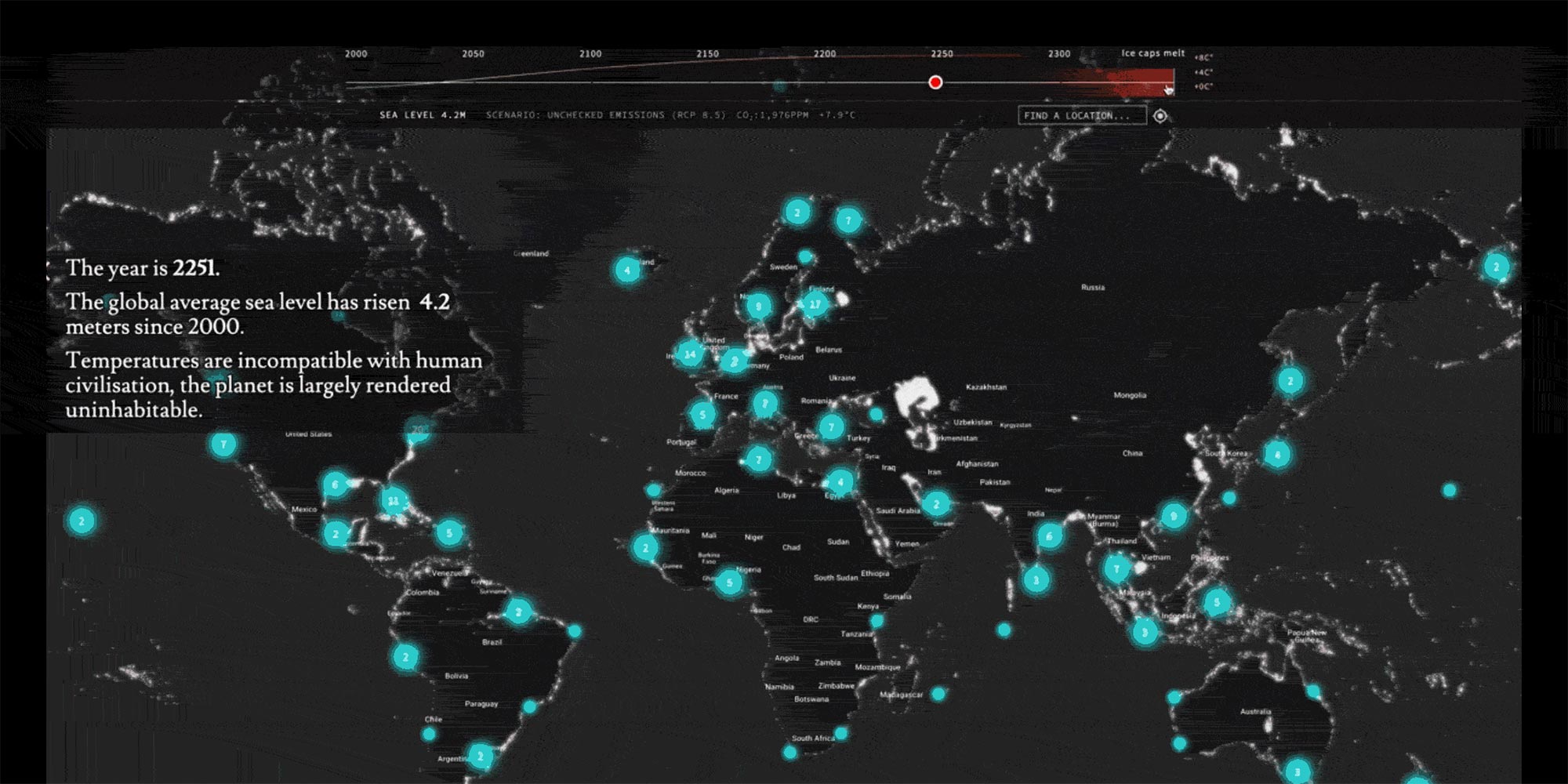
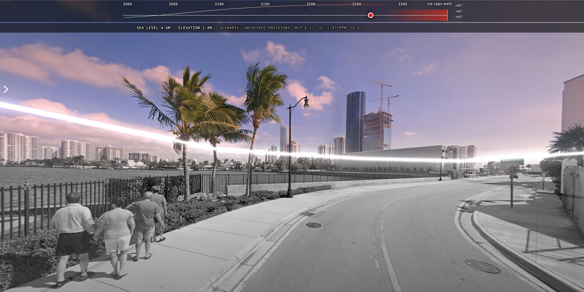
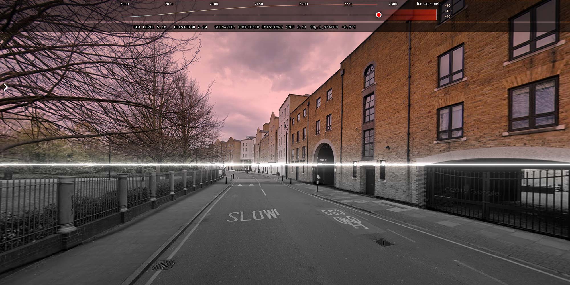
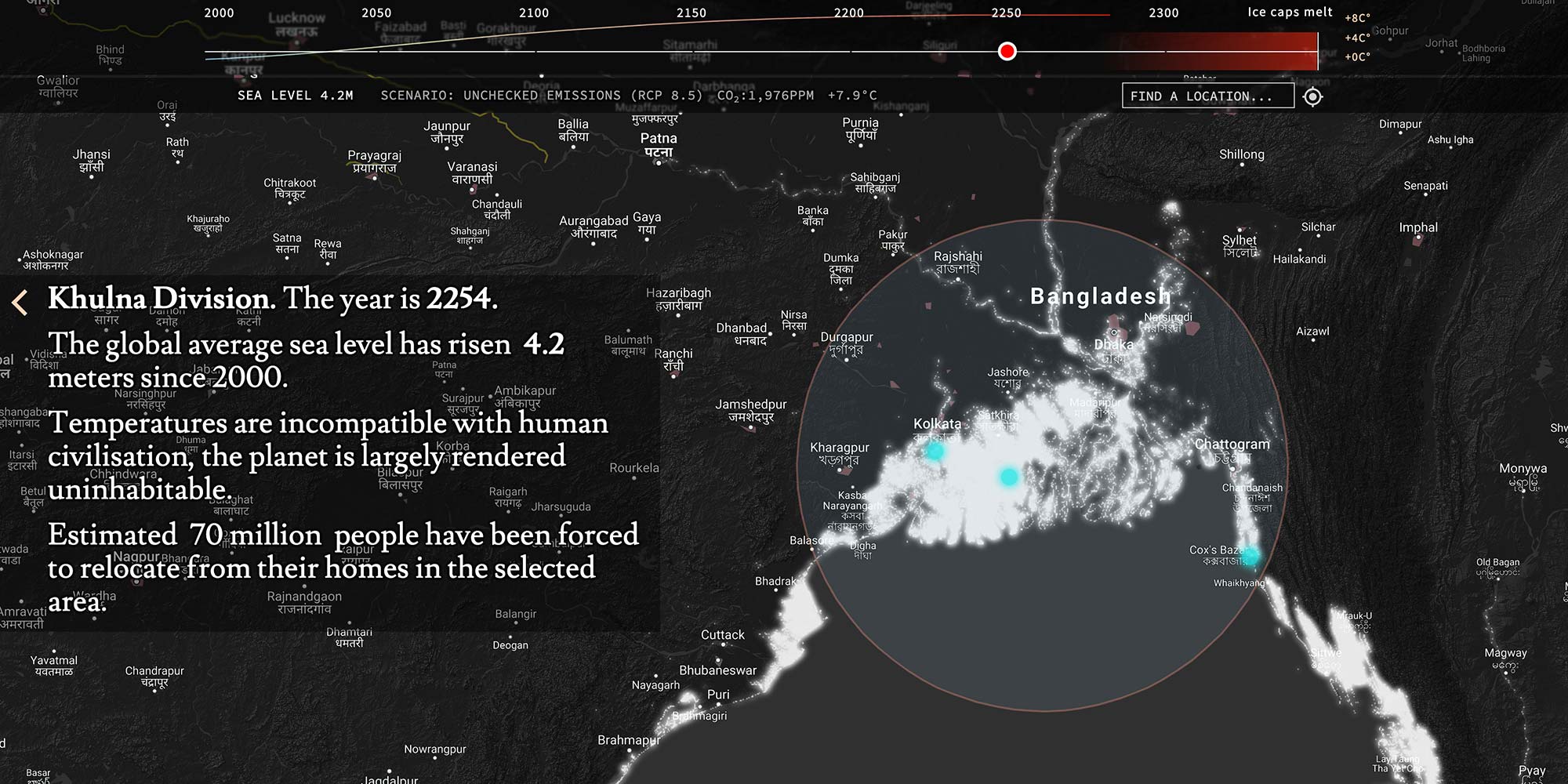
As part of Heartbeat of the Earth a series of online interactive artworks interpreting climate data, using Google Maps and Street View, artists Pekka Niittyvirta and Timo Aho visualize the predicted sea level rise – and the number of people likely to be displaced – in more than 200 different locations between the years 2000 and 2300.
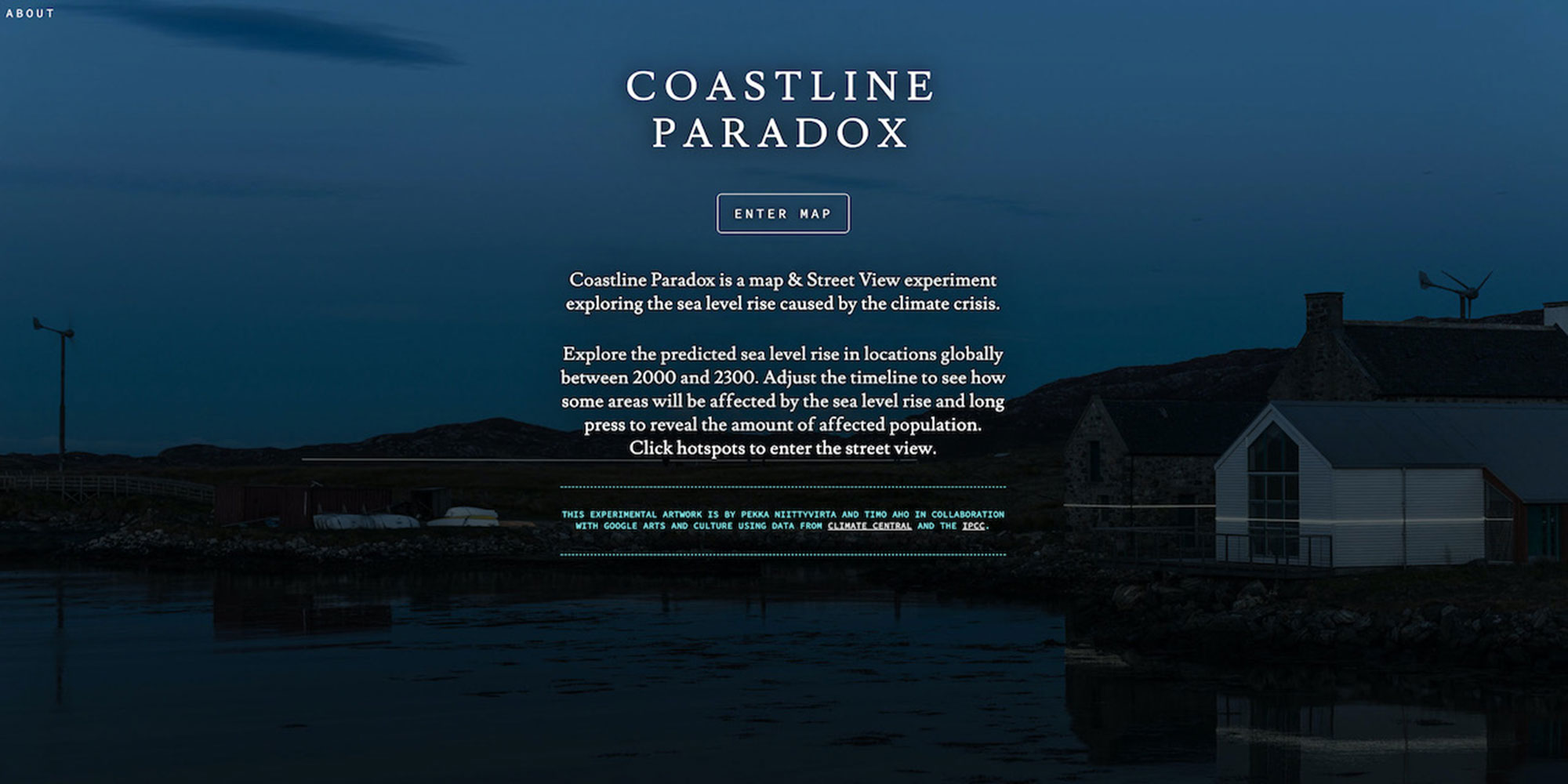
A map and Street View experiment visualizing the actual and predicted global sea level rise caused by the climate crisis. The artists Timo Aho and Pekka Niittyvirta (FIN) invite the viewer to explore a world where sea levels rise and instability increases the further, we advance into the future. The artwork is designed to work on Google Street View, and a custom-built map interface Google Maps. It uses data from Climate Central and findings from the IPCC report to visualize present and future sea level rise and simulates the migration caused by rising global temperatures.
Video
Credit: Google Arts & Culture – Heartbeat of the Earth

Credit: Google Arts & Culture – Heartbeat of the Earth

Credit: Google Arts & Culture – Heartbeat of the Earth
Credit: Google Arts & Culture – Heartbeat of the Earth
Credit: Google Arts & Culture – Heartbeat of the Earth
Credit: Google Arts & Culture – Heartbeat of the Earth
Biographies
Timo Aho (FI)
Timo Aho (b. 1980, Finland) works with site-specific installation, sculpture and intervention, using a wide range of materials and media, often including ephemeral elements such as light and air. His artistic practice investigates our environment through societal structures and belief systems. Examining the fine line between reality and fiction, Aho disentangles these topics with subtle gestures.
http://www.timoaho.org/
Pekka Niittyvirta (FI)
Pekka Niittyvirta’s (b. 1974, Helsinki) work is often dealing with consequences of human actions, whether they are related with the society, technology, environment or the financial market. He mostly uses photography and video as a material in various ways to depict a situation or phenomena
http://www.niittyvirta.com/